 Sedona City Guide
Doe Mountain
Doe Mountain Trail No. 60 climbs 0.7 miles of switchbacks to a flat mesa top in the Dry Creek district of West Sedona, then adds a 1.3-mile loop around the rim for anyone who wants the full circuit. This page covers the climb, the view it buys for the effort, the Red Rock Pass the trailhead requires, and why the exposed switchbacks and shadeless summit make this the wrong hike to start at noon in July. The full Sedona hiking trails list ranks every trail in town; hiking safety covers heat and monsoon risk across all of them. How a first-timer should sequence Sedona's trails at all is covered on the homepage.
Quick answer A short steep climb, a flat mesa top, and why midday summer is the wrong time
Doe Mountain Trail climbs 0.7 miles of switchbacks to a flat mesa top, 542 feet of gain, rated Moderately challenging; the full rim loop adds 1.3 miles roundtrip for about 1.5 hours total. It's one of the best view-for-effort trails in the area, and one of the worst to start with no shade or water in a summer afternoon.
Key takeaways
- Parking here needs a Red Rock Pass, $5 for the day. This trailhead is on the standard fee list, the same as Boynton Canyon nearby
- The switchback climb is entirely exposed, no tree cover anywhere on the route, so a July midday start is a real heat risk; hiking safety covers what to carry and when to turn back
- Once you're on top the rim loop is essentially flat, so the climb itself, not the distance, is the only hard part of this hike
Key facts
Opening hours
| Trailhead, all year | Not gated; Forest Service publishes no fixed hours for this trailhead–Not stated |
|---|
Closed Not stated by the Forest Service page fetched for this guide
Admission
- Adult
- Free to walk; $5 daily / $15 weekly / $20 annual Red Rock Pass required to park at the trailhead
- Reduced
- Not applicable
- Free
- Not applicable: this is one of the trailheads that does require the pass
Planning it
- Time needed
- About 1.5 hours for the full climb plus the rim loop, the Forest Service's own figure
- Book ahead
- Optional — walk-up usually fine
- Address
- Doe Mountain / Bear Trailhead, Boynton Pass Road, Dry Creek district, West Sedona, AZ
The one way in, priced from the Coconino National Forest pass program, read on 9 September 2026. There's no ticket or admission fee here, only the parking pass the trailhead requires.
Are you climbing the mesa yourself, or riding the paved district roads around it instead?
| Option | Price | What it gets you | Best for | Book |
|---|---|---|---|---|
| Buy a Red Rock Pass and drive to the trailheadThe only documented way in: there is no shuttle here | $5 daily / $15 weekly / $20 annual | The Forest Service's own trailhead lot, which its page calls "ample" | Anyone doing the climb and the rim loop | Official site |
| Ride the Dry Creek e-bike tour insteadThis tour rides paved roads past several trailheads in the area, not up Doe Mountain itself | $135 | A 2-hour paved e-bike route through the same Dry Creek district to the Amitabha Stupa | Anyone who wants the district's scenery without the mesa climb itself | Check Availability |
The pass price and terms come from the Forest Service's own Red Rock–Coconino Passes Program page; the e-bike tour price is GetYourGuide's listed rate on 9 September 2026. The e-bike route stays on pavement and does not climb the mountain. It's a way to see the surrounding district, not a substitute for the trail itself.
See the Dry Creek district without the climb
This is a paved district ride, not a route up the mountain itself; the price is GetYourGuide's own listed figure, read 9 September 2026.
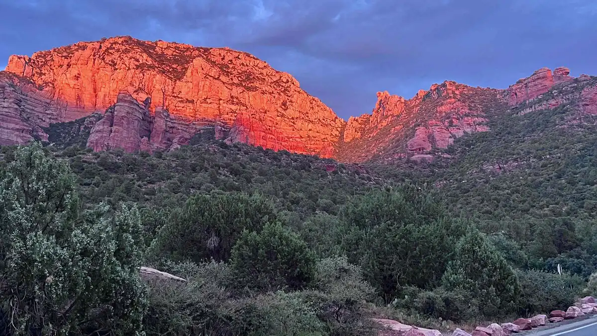 from $135
Sedona: E-Bike Sunset Tour Dry Creek area and Stupa
A paved e-bike route through the Dry Creek area to the Amitabha Stupa, combining a red rock ride with a stop most visitors otherwise drive to. Suits riders who want to see the Stupa as part of an active outing rather than a quick parking-lot visit.
Check AvailabilityPrices, ratings and details are the platform's own, checked in Q3 2026; dollar figures are the listed prices — the platform bills in your account's currency.
The climb, the rim loop, and the view they buy
The Forest Service's own trail page is short: a steep short climb, then a flat loop on top. That's the entire route.
0.7 miles of switchbacks to the mesa top
The trail's only real work happens in its first 0.7 miles: a series of switchbacks climbing 542 feet up the mountain's south face to the flat mesa top. The Forest Service rates the whole route Moderately challenging, and on this trail that rating lives almost entirely in this stretch, steep, exposed, no shade, loose gravel in places where the switchbacks turn. It's short enough that most hikers manage it without difficulty, but it is a genuine climb, not a graded path.
The rim loop: 1.3 miles roundtrip, essentially flat
Once you're on top, the character of the hike changes completely. The mesa summit is flat, and the loop around its rim runs 1.3 miles roundtrip with almost no additional elevation change, the Forest Service's figures show the entire route's 542 feet of gain happening on the way up, not on the loop itself. That makes the summit loop the easy half of a hike whose difficulty is front-loaded into the first twenty minutes.
What the mesa top gets you
This is a formation, not a canyon or a spring, and the payoff is entirely the view: an open, near-360-degree look across the Dry Creek district toward Boynton Canyon, the wider red-rock skyline, and, depending on haze and season, distant peaks beyond Sedona itself. The Forest Service's page names no specific named overlook or photo point on the rim; the whole loop is the view, walked at whatever pace the visit calls for.
Who this hike suits, and who it doesn't
The short distance and the big payoff make Doe Mountain a favorite recommendation for visitors with limited time or limited hiking experience, and for that group the trail mostly delivers: 1.5 hours total, a single sustained climb rather than repeated ups and downs, and a flat summit that rewards the effort immediately rather than after miles of buildup. It suits a sunrise or late-afternoon visit particularly well, when the low light does the most for the view and the temperature is at its most forgiving.
It suits poorly anyone with a knee or balance concern on loose gravel switchbacks, anyone hiking with young children who tire on a steep grade, and anyone whose Sedona itinerary only allows a midday slot in summer. None of those are reasons to skip Doe Mountain outright; they're reasons to pick the hour carefully, which is true of very few other trails on this site's list to the same degree.
How much time to give Doe Mountain
The Forest Service states one figure for the whole route; these three routings are ours, built around the climb versus the loop.
The variable here is whether the rim loop is worth the extra flat walking once you've already done the hard part getting up. Most visitors who make the climb do the full loop, since it adds so little effort for the view.
| Routing | What you get | What it skips | Door to door |
|---|---|---|---|
| Just the climb | The switchbacks and a first look from the mesa edge | The full rim loop's other viewpoints | About 30 to 40 minutes roundtrip |
| The full loop | The climb plus the complete 1.3-mile rim circuit, the Forest Service's own routing | Nothing on this trail; it's a short, complete route | About 1.5 hours total, the Forest Service's stated figure |
| By e-bike instead | The Dry Creek district tour covers the surrounding paved roads and the Amitabha Stupa | The mesa climb and the rim view entirely. This stays on pavement | 2 hours, guided, no climbing |
No shade, no water, and why midday summer is the wrong time
The Forest Service's fetched trail page states no heat warning specific to Doe Mountain, but the terrain speaks for itself: the switchback climb runs up an exposed south-facing slope with no tree cover anywhere on the route, and the flat mesa top offers none either. There is no water source anywhere on this trail, official or otherwise; whatever you carry in is what you have.
That combination, an entirely shadeless climb and a summit with nowhere to escape the sun, is exactly the profile that turns dangerous fastest in a Sedona summer, when afternoon temperatures regularly climb well past what the switchbacks are comfortable in. Starting this hike at midday in June through August, when the sun is highest and the climb offers no relief, is a choice this guide would steer around; an early morning or a cooler-season visit gets you the same view without the added heat load. Hiking safety covers water quantities and heat-illness warning signs for trails across Sedona generally.
The trailhead: a Red Rock Pass, and the lot the Forest Service calls "ample"
Doe Mountain shares its trailhead lot with the Bear Trail, in the Dry Creek district off Boynton Pass Road, and the Forest Service's own page requires a Red Rock Pass or America the Beautiful Interagency Pass to park here, $5 for the day, $15 for the week, $20 for the year, sold online, at fee kiosks, or at the Red Rock Ranger Visitor Center. That puts it in the same bracket as Boynton Canyon and unlike Soldier Pass or Broken Arrow, neither of which requires the pass.
The Forest Service's own description calls its parking "the ample parking lot at its trailhead," though the fetched page gives no specific vehicle-count figure to back that adjective, and no Sedona Shuttle route serves this trailhead if it does fill. Take the Forest Service's own word for the lot's size at face value, but arrive with a plan B on a busy weekend regardless, since nothing here is documented beyond that one word.
At Doe Mountain: what to do, and what not to
Every line here is argued somewhere above; this is the version you can act on that morning.
Do
- Buy the Red Rock Pass before you arrive; this trailhead is on the standard fee list
- Start early, well before midday in summer. The switchback climb has no shade anywhere on it
- Carry all the water you'll need; there's no source on the trail
- Do the full 1.3-mile rim loop once you're on top; it adds little effort for a lot more view
- Wear shoes with grip for the loose gravel on the switchback turns
Don't
- Don't start this hike at midday between June and August; the exposed climb and shadeless summit are a real heat risk then
- Don't expect a shuttle backup if the trailhead lot is full; no Sedona Shuttle route serves Doe Mountain
- Don't treat the Forest Service's "ample" description as a guaranteed space; the page gives no actual vehicle count
- Don't skip the switchbacks' loose sections carelessly; the climb, not the rim loop, is where the elevation gain happens
- Don't expect a specific named viewpoint on the rim; the entire loop is the view, with no single marked overlook
Five things most visitors do not know about Doe Mountain
All five come off the Forest Service's own trail page or the pass program it runs, each changing something practical about the visit.
- Nearly all the elevation gain happens in the first 0.7 miles. The 1.3-mile rim loop on top is essentially flat, so the climb, not the distance, is what makes this Moderately challenging [fs.usda.gov Doe Mountain Trail No. 60, read 2026-09-09]. - This trailhead does require a Red Rock Pass. Unlike Soldier Pass or Broken Arrow, Doe Mountain sits on the Forest Service's standard fee-site list; $5 buys a day [fs.usda.gov Red Rock–Coconino Passes Program, checked 2026-09-09]. - The Forest Service calls its own lot "ample" without stating a number. No vehicle-count figure backs that word on the fetched page, so treat it as the agency's own characterization, not a guarantee [fs.usda.gov Doe Mountain Trail No. 60]. - There is no shuttle service to this trailhead. The free Sedona Shuttle's published route list does not include Doe Mountain [sedonashuttle.com, checked 2026-09-09]. - No official heat warning is published for this specific trail, despite the climb's total lack of shade. The agency's general Coconino National Forest alerts cover fire and road closures elsewhere, not a heat advisory for Doe Mountain by name [fs.usda.gov, checked 2026-09-09].
Doe Mountain map: trailhead and next stops
The shared Doe Mountain / Bear trailhead and the sights within a short drive.
Next stop from Doe Mountain
Drive minutes are our estimates from the GPS distances between trailheads.
Boynton Canyon Trail
A much longer canyon hike in the same Dry Creek district, also needing a Red Rock Pass. Boynton Canyon guide.
About 5 min by carAmitabha Stupa & Peace Park
Free, dawn-to-dusk grounds, and the other stop on the e-bike tour that also passes this trailhead's district. Amitabha Stupa guide.
About 8 min by carDevil's Bridge Trail
A short drive away, with two of its three approaches served by the free shuttle that doesn't reach Doe Mountain. Devil's Bridge guide.
About 10 min by carDoe Mountain questions
How long does Doe Mountain take to hike?
About 1.5 hours for the full route: 0.7 miles of switchbacks to the mesa top, then the 1.3-mile rim loop, 542 feet of total elevation gain, the Forest Service's own figures. Skipping the rim loop and just reaching the mesa edge takes about 30 to 40 minutes roundtrip.
Is Doe Mountain a hard hike?
The Forest Service rates it Moderately challenging, and nearly all the difficulty sits in the first 0.7 miles of exposed switchbacks. Once you're on the flat mesa top, the 1.3-mile rim loop is easy walking with almost no further elevation change.
Do you need a Red Rock Pass for Doe Mountain?
Yes. The Doe Mountain / Bear Trailhead is on the Forest Service's standard Red Rock Pass fee-site list: $5 for the day, $15 for the week, $20 for the year, or the America the Beautiful pass, the same requirement as nearby Boynton Canyon.
Why is Doe Mountain closed?
The Forest Service's fetched trail page lists no active closure specific to Doe Mountain; general Coconino National Forest alerts covering fire restrictions or nearby road closures can affect access at times, so check the trail's own Forest Service page directly if a closure claim shows up elsewhere online.
Is there shade or water on Doe Mountain Trail?
No. The switchback climb and the flat mesa top are both fully exposed, with no tree cover and no water source anywhere on the route. Carry everything you need, and avoid starting this hike at midday in a Sedona summer.
Is Doe Mountain a good hike for a first-timer?
Yes, for the view-to-effort ratio: a short, steep 0.7-mile climb buys a near-360-degree view from a flat mesa top most first-timers can manage in under two hours. The lack of shade is the real limiting factor, not the terrain itself, so time it for morning or a cooler month.
Where Doe Mountain fits in a Sedona day
This is a short hike that rewards an early start: get to the trailhead before the heat builds, do the 0.7-mile climb, then walk the full 1.3-mile rim loop for about 1.5 hours total, all before the mesa's total lack of shade becomes a problem. Boynton Canyon sits five minutes away in the same Dry Creek district for a much longer second hike, and the Amitabha Stupa is a quiet, free stop nearby if the morning calls for something gentler after the climb. If the switchbacks aren't for you, the Dry Creek district e-bike tour covers the same surrounding roads on pavement. The full hiking trails list ranks everything else in town.
Doe Mountain on Film: The Climb and the Mesa-Top View
Three walk-throughs showing the switchback climb and the flat summit loop, including a heat-and-timing warning worth watching before a summer visit.
Hiking to the STUNNING View from Doe Mountain | Coconino National Forest | Sedona, AZ
A full route from the trailhead through the switchbacks to the mesa-top view.
Video: Adam HoytDO NOT Hike Doe Mountain in Sedona Without Watching this First
Practical warnings about the exposed climb and timing, useful alongside this page's heat section.
Video: LIVIN In SedonaDoe Mountain | Sedona
A shorter look at the rim loop and the views it buys once you're on top.
Video: 14er FinisherVideos load from YouTube only when you press play.
Reviewed Q3 2026 (July–September 2026); next review Q4 2026. Prices, hours and terms are set by the venue or operator and confirmed at checkout.
We may earn a commission if you book through one of our links, at no extra cost to you. Full affiliate disclosure