 Sedona City Guide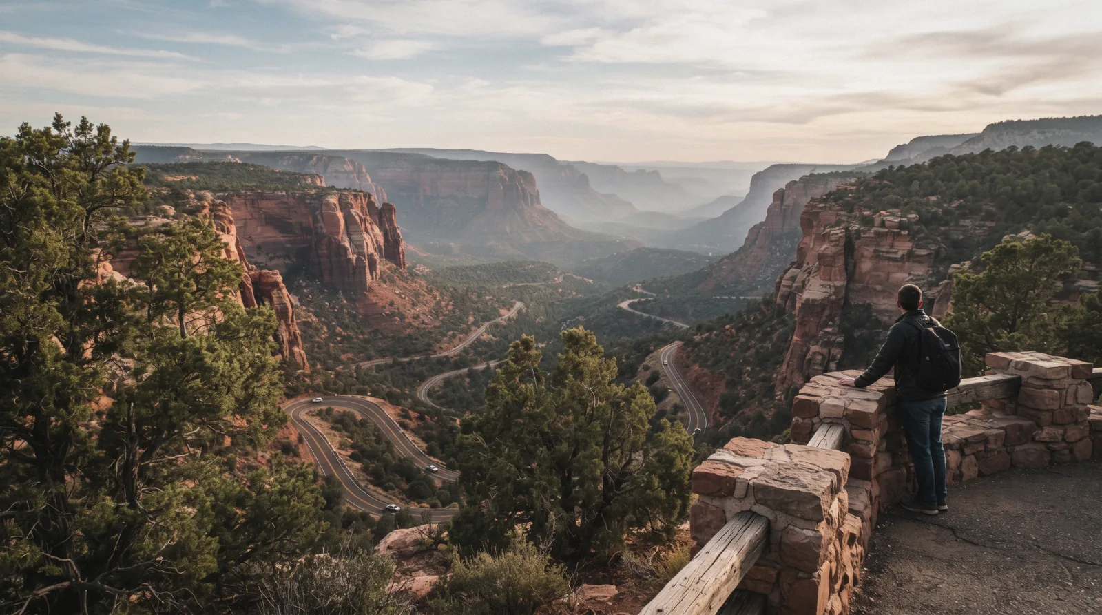
Oak Creek Canyon
Oak Creek Canyon is the 27-mile stretch of Highway 89A between Flagstaff and Sedona, dropping nearly 1,000 feet down a series of switchbacks from the Mogollon Rim to the canyon floor and then running alongside Oak Creek the rest of the way. This page treats it as what it is: a drive, organized stop by stop, the overlook, the fee sites strung along the creek, the fall-colour weeks, the monsoon flash-flood risk in a canyon with one road, and the winter conditions that change the trip. Slide Rock and West Fork Trail are two of its named stops with their own pages; the other scenic road out of Sedona, SR-179, gets its own section near the bottom, and the case for spending more than one day in Sedona is made on the homepage.
Quick answer The route, the overlook, the fee sites and the two hazards to plan around, in three lines
Oak Creek Canyon is Highway 89A itself: 14 miles of switchbacks dropping nearly 1,000 feet from Flagstaff, then 13 more miles beside Oak Creek into Sedona. The drive is free; the fee sites along it. Slide Rock, West Fork, Grasshopper Point and others. Each charge their own separate rate.
Key takeaways
- Oak Creek Vista, at 6,437 feet, is the one formal overlook, with vault restrooms and a seasonal Native American marketplace. Nearly every named fee site is downhill from it toward Sedona
- The Coconino National Forest issues Flash Flood Warnings for Oak Creek specifically during the June 15-September 30 monsoon window; a hike into a side wash or narrow section is the wrong call when one is active
- A Sedona highlights tour drives this same road with a guide narrating the geology if you'd rather not do the switchbacks yourself
Key facts
Opening hours
| The road itself | Always open–No gate or seasonal closure published |
|---|---|
| Oak Creek Vista information booth | 9:00 am–4:00 pm (early April through November) |
Closed Not stated. The highway itself has no closed days; individual fee sites keep their own hours
Admission
- Adult
- Free to drive the road; Red Rock Pass sites $5 daily / $15 weekly / $20 annual
- Reduced
- Not applicable
- Free
- The drive, the overlook and the Native American marketplace at Oak Creek Vista
Planning it
- Time needed
- Not stated by the Forest Service; our routing: 45 minutes to drive it straight through, 3-4 hours with the overlook and a fee-site stop or two
- Book ahead
- Optional — walk-up usually fine
- Address
- Highway 89A between Flagstaff and Sedona, Arizona
The road itself has no fee. What costs money are the individual stops along it, read from fs.usda.gov and azstateparks.com in Q3 2026. The comparison below is the ways to see the canyon rather than a single ticket.
Are you driving the canyon yourself, or do you want a guide handling the switchbacks and the geology?
| Option | Price | Includes | Cancel | Book |
|---|---|---|---|---|
| Self-drive on Highway 89AAnyone with a car who wants to set their own pace and pick their own stops | Free; fee sites along it charge separately | The full switchback-to-creek route, stop where you like | Not applicable | Official site |
| Sedona highlights sightseeing tourVisitors without a car, or anyone who would rather not drive the switchbacks themselves | From $63 | Guided drive with geology and history commentary, photo stops | Not stated as refundable | Check Availability |
| Airplane tour over Verde Valley and Sycamore CanyonAnyone who wants the canyon country from above rather than from the switchbacks | From $109.40 | An aerial view of the region's canyon country, different vantage from the road | Not stated as refundable | Check Availability |
No affiliate tour sells a ticket to "Oak Creek Canyon" as a single product. It is a public road, and the money is spent at the individual fee sites along it or on a guided drive.
Guided ways to see the canyon
Each of these puts a guide on the same road or above it. Prices in USD as listed in tours.json, read in Q3 2026.
 from $111.50
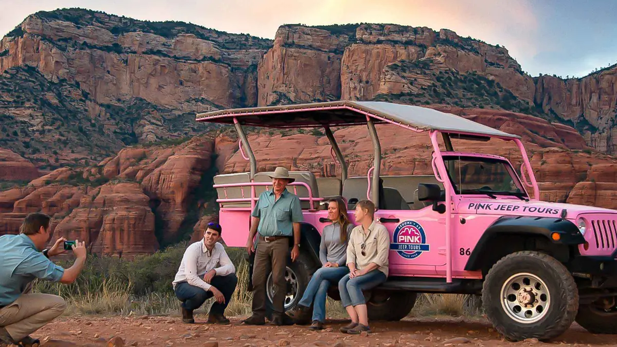
Sedona: Red Rock Range Pink Jeep Tour
A short Jeep run on mild dirt roads west of town to open panoramic viewpoints over Sedona's red rocks, including Thunder Mountain and Bradshaw Overlook. Suits first-time visitors who want scenery without a rough ride.
Check Availability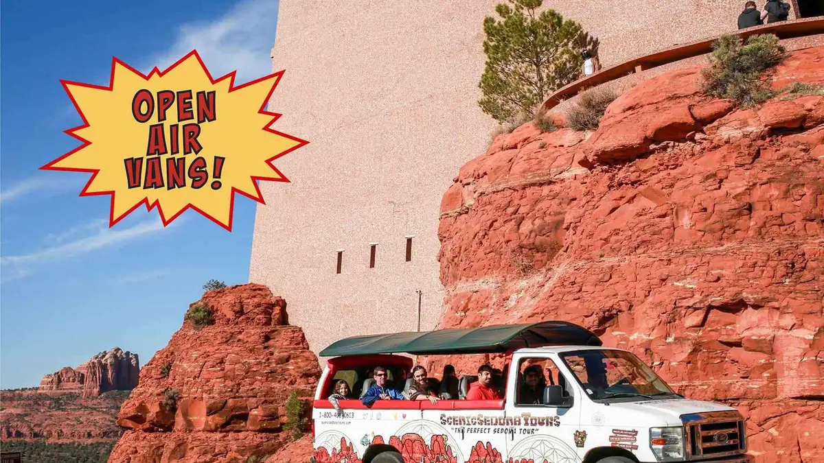 from $126
Most-reviewed sightseeing tour on this page (212 reviews)
from $126
Most-reviewed sightseeing tour on this page (212 reviews) Sedona: Open-Air Van Tour with a Local Guide and 6 Stops
A longer open-air van circuit with six stops mixing sightseeing, shopping and food rather than a single scenic loop. Suits visitors who want to break up the drive with time on foot at each stop.
Check Availability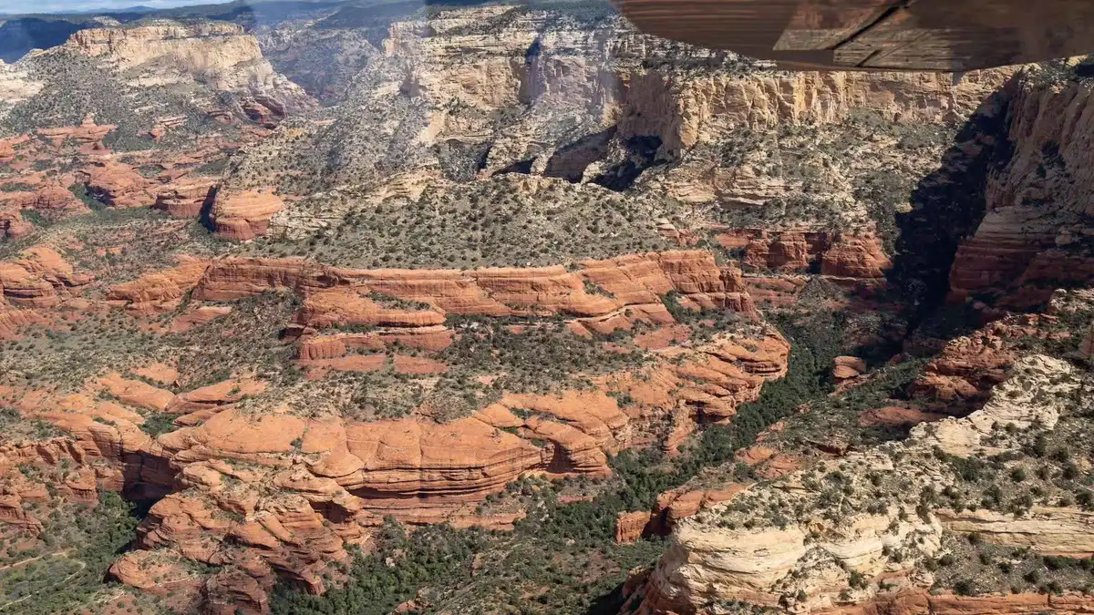 from $109.40
Sedona: Verde Valley & Sycamore Canyon Airplane Tour
A 50-minute fixed-wing flight from Cottonwood Airport over the Verde Valley, Jerome, and Sycamore Canyon (sometimes called the miniature Grand Canyon), with Boynton Canyon visible on the return leg. Suits travelers based near Cottonwood who want more range than a Sedona-based helicopter loop. A new listing on GetYourGuide with no reviews yet.
Check Availability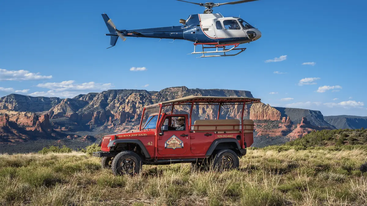 from $306.48
Sedona: Helicopter & Off-Road Jeep Adventure
A combo booking that pairs a short helicopter pass over Cathedral Rock, Bell Rock and Boynton Canyon with a 2-hour Jeep tour of the high-desert trails below, using one pickup point for both legs. Suits travelers who want the aerial view and the ground-level trail experience without booking two separate tours. A new listing on GetYourGuide with no reviews yet.
Check AvailabilityPrices, ratings and details are the platform's own, checked in Q3 2026; dollar figures are the listed prices — the platform bills in your account's currency.
The drive, start to finish: switchbacks to creek
Coming from Flagstaff, the road does one big thing early and then settles into a long, scenic straightaway beside the water.
14 miles, then the switchbacks, then 13 more along the creek
The Forest Service's own description of the route is direct: driving south from Flagstaff on Highway 89A, "14 miles down the road it drops nearly a thousand feet down a series of switchbacks to the canyon floor and continues for 13 more miles alongside Oak Creek in Oak Creek Canyon" [fs.usda.gov]. That single descent is the part of the drive most people remember, tight curves, a few pull-offs to let faster traffic pass, and the elevation change from around 6,400 feet at the top to roughly 5,000 feet where the canyon floor levels out near the fee sites [fs.usda.gov general elevation figure for the canyon]. From Sedona's direction, the drive is the same road run in reverse: flat and creek-side at first, then the climb up the switchbacks toward Flagstaff.
Oak Creek Vista: the one formal overlook
Oak Creek Vista sits at the top of the switchbacks, 6,437 feet up, 13 miles north of Sedona and 14 miles south of Flagstaff on SR-89A [fs.usda.gov]. It has vault restrooms, a seasonal Arizona Natural History Association information booth (generally 9:00 am to 4:00 pm, early April through November, weather permitting), and a Native American marketplace where vendors set up to sell crafts. The overlook and marketplace run year-round except Thanksgiving and Christmas [fs.usda.gov].
It is the only formal, signed viewpoint on the drive. Most of the rest of the canyon is seen from the car or from one of the fee sites below.
The fee sites strung along the creek
Below the switchbacks, Highway 89A runs past a series of named recreation sites, each with its own small parking area and its own fee. The Forest Service's own recreation page for the canyon lists Grasshopper Point Swimming/Picnic Area, Banjo Bill Picnic Site, Encinoso Picnic Site, Halfway Picnic Site, Call of the Canyon Picnic Site (the entrance to West Fork Trail), Slide Rock State Park and Midgley Bridge Observation Site, in that general order along the road [fs.usda.gov]. None of them has its own parking lot large enough for a bus stop, and several are pull-offs rather than developed lots, so passing them at a crawl looking for a space is normal on a summer weekend.
Most of these are Coconino National Forest fee sites where a Red Rock Pass or an America the Beautiful pass covers parking. But five are managed by an outside concessionaire and are NOT covered by the America the Beautiful pass: Call of the Canyon/West Fork, Crescent Moon Picnic Site, Grasshopper Point, Beaver Creek Day Use and Lower Lake Mary. Those five need a separate Coconino Hospitality Annual Pass or their own posted day fee instead [fs.usda.gov Red Rock Pass program page]. Slide Rock State Park is different again. It is an Arizona State Park with its own per-vehicle gate fee, and no forest pass of any kind applies there.
| Site | What it is | Pass that covers it | Notes |
|---|---|---|---|
| Midgley Bridge | Overlook, picnic | Red Rock Pass / America the Beautiful | First stop leaving Sedona |
| Grasshopper Point | Swimming, picnic | Coconino Hospitality Pass (concessionaire) | Not covered by America the Beautiful |
| Halfway Picnic Site | Picnic, creek access | Red Rock Pass / America the Beautiful | Standard Forest Service site |
| Encinoso Picnic Site | Picnic, creek access | Red Rock Pass / America the Beautiful | Standard Forest Service site |
| Banjo Bill Picnic Site | Picnic, creek access | Red Rock Pass / America the Beautiful | Named on the Forest Service's own recreation page |
| Call of the Canyon (West Fork) | Trailhead, picnic | Coconino Hospitality Pass (concessionaire) | Its own $15/day fee: see West Fork Trail |
| Slide Rock State Park | State park, swim area | None: separate state gate fee | See Slide Rock fees |
Fall color: what drives it, and what nobody publishes
The canyon's deciduous trees: chiefly bigtooth maple mixed with cottonwood and sycamore along the creek. Turn against the evergreen ponderosa pine and red sandstone walls, and the effect is the reason the drive gets busy every autumn. The Forest Service's own description of nearby West Fork calls the canyon "ablaze with color, with red and gold leaves floating in clear reflecting pools" in autumn [fs.usda.gov West Fork Trail page]. The same creek runs the length of Oak Creek Canyon, so the description applies to the wider drive, not only that one trail.
No official Coconino National Forest or Arizona tourism page we could fetch this run publishes a specific "peak week" or a species-by-elevation timing chart for the canyon's fall color, and a search for a dedicated fall-color report page returned nothing live. What is true generally of Arizona's higher-elevation canyons, color starting at the rim near Oak Creek Vista's 6,437 feet and working down toward Sedona's roughly 4,500 feet as the weeks pass. Is a pattern, not a published date range; treat any specific "peak weekend" you read elsewhere as someone's observation, not an official forecast, and expect the change to run through several weeks in mid-autumn rather than one weekend.
Monsoon season: the flash-flood risk in a one-road canyon
Arizona's monsoon runs a fixed calendar window, June 15 through September 30, set by the National Weather Service in 2008 and applied statewide, including the Flagstaff/Sedona region [weather.gov]. The first weeks are typically quiet; storm activity usually picks up in early to mid-July, August is the busiest month, and activity winds down through September [NWS Flagstaff guidance].
NWS Flagstaff issues Flash Flood Warnings that explicitly cover "Oak Creek and Sycamore Canyons," and its guidance is specific: flash flooding is possible in creeks, normally dry washes and swimming holes, with "raging killer currents possible in side canyons and narrow slot canyons". And it recommends changing plans for hikes into slot canyons or washes when a warning or watch is active [weather.gov, NWS Flagstaff]. Oak Creek Canyon is a single road with the creek running alongside it for most of its length, so a storm upstream near Flagstaff can raise the creek at fee sites and trailheads well before rain reaches Sedona itself. Check the forecast for the whole canyon, not just your own location, before a summer-afternoon drive or hike here.
- Monsoon window: June 15 - September 30 (fixed calendar, NWS)
- Busiest month: August; quietest early weeks: mid-June
- NWS names Oak Creek Canyon directly in its flash-flood guidance
- A storm upstream near Flagstaff can raise the creek at Sedona-side sites before local rain arrives
Winter: ice, snow, and what is not officially confirmed
Arizona runs on Mountain Standard Time year-round and does not observe daylight saving, so a winter drive up the canyon loses daylight earlier than a visitor arriving from a daylight-saving state expects. Plan the switchbacks for daylight hours rather than assuming an evening clock time that no longer matches your home time zone. The switchback section climbs from around 5,000 feet on the canyon floor to 6,437 feet at Oak Creek Vista, and that elevation swing is enough for snow and ice to form on the curves well after Sedona itself is clear and dry.
No official Arizona Department of Transportation or Forest Service page we could fetch this run states a standing winter closure policy for Highway 89A through the canyon. The road is not routinely gated shut the way some higher, more remote forest roads are. The live authority for same-day conditions is Arizona's own traveler-information service, az511.gov, which is the source to check the morning you plan to drive the switchbacks in winter rather than any fixed rule printed here.
Carry chains or cold-weather tires as a precaution from roughly November through March, and expect the road to be more forgiving lower in the canyon than at the Oak Creek Vista summit.
The other drive out of Sedona: SR-179
Oak Creek Canyon is not Sedona's only scenic road. State Route 179, the Red Rock Scenic Byway running south from Uptown Sedona through the Village of Oak Creek, is the other, and it passes Cathedral Rock, Bell Rock and Chapel of the Holy Cross on its way to I-17. The road and the SR-89A junction in Uptown were rebuilt with multiple roundabouts by ADOT, confirmed at the Y junction itself and at 179's Canyon Drive, Morgan Road and Chapel Road intersections.
Though no single official page states the exact total roundabout count on the corridor, so that number is left unpublished here rather than guessed [sedonaaz.gov news release]. Where SR-89A is a mountain drive through a forested canyon, SR-179 is a lower, open red-rock drive with its own named stops; each of those has its own page on this site rather than being folded into this one.
Driving Oak Creek Canyon: What To Do, And What Not To
Every line here is argued in the sections above, compressed into the call you make before you leave.
Do
- Drive it in the morning on a summer weekend. The switchback pull-offs and fee-site lots fill by midday
- Check az511.gov before a winter drive; ice forms on the switchbacks well after Sedona itself is dry
- Check the forecast for the whole canyon, not just Sedona, during the June 15-September 30 monsoon window
- Carry a Red Rock Pass if you plan to stop at Midgley Bridge, Halfway or Encinoso along the way
- Treat Slide Rock and West Fork as separate fees from each other and from the Red Rock Pass
Don't
- Don't assume the America the Beautiful pass covers every fee site. Grasshopper Point and Call of the Canyon are concessionaire-run and need their own pass or fee
- Don't hike into a side wash or narrow stretch of the canyon when a flash-flood warning is active. NWS names Oak Creek explicitly in its guidance
- Don't expect a formal overlook anywhere but Oak Creek Vista. Most of the rest of the canyon is seen from the road or a fee-site pull-off
- Don't drive the switchbacks distracted by the view. There is no shoulder on most curves, only the marked pull-offs
- Don't skip SR-179 assuming it is the same drive as 89A. It is a different road with different named stops south of Sedona
Oak Creek Canyon In Five Dates
The canyon's road history in the order the facts above already argue it.
-
1914
The canyon road is completed
The first through-road connects the canyon floor to what becomes Highway 89A, enabling the tourist trade that followed.
-
1933
Pendley builds tourist cabins at what is now Slide Rock
One of the first pieces of tourism infrastructure along the new road.
-
1938
The canyon road is paved
Paving encourages the recreational use of the canyon that continues today.
-
1985
Slide Rock becomes a state park
Arizona State Parks buys the former Pendley homestead, formalising one of the canyon's fee sites.
-
2008
NWS fixes the statewide monsoon calendar
June 15-September 30 becomes the standard window the National Weather Service uses for flash-flood messaging, Oak Creek Canyon included.
Road and park dates as recorded on Wikipedia and azstateparks.com; the monsoon calendar date from weather.gov's Flagstaff office, all read in Q3 2026.
Five Things Most Visitors Don't Know About Oak Creek Canyon
All five change something practical about the drive, sourced to the agencies that publish them.
- The switchback descent is nearly 1,000 feet over a short stretch. The Forest Service's own route description states the road "drops nearly a thousand feet down a series of switchbacks" inside the first 14 miles from Flagstaff [fs.usda.gov]. - Five fee sites are NOT covered by the America the Beautiful pass, even though most Forest Service sites in the area are. Call of the Canyon, Crescent Moon, Grasshopper Point, Beaver Creek and Lower Lake Mary all need a separate Coconino Hospitality Annual Pass instead [fs.usda.gov Red Rock Pass program page]. - The National Weather Service names Oak Creek Canyon specifically in its flash-flood guidance, not just generically. A sign the agency treats this canyon's single-road, creek-side layout as a particular risk [weather.gov, NWS Flagstaff]. - Oak Creek Vista's information booth is seasonal, not year-round, generally April through November, 9:00 am to 4:00 pm, weather permitting, while the overlook and Native American marketplace run all year except Thanksgiving and Christmas [fs.usda.gov]. - There is no official winter closure policy published for the road itself, despite the elevation swing to 6,437 feet at the summit, the canyon is not gated shut as a matter of routine, and az511.gov is the only reliable same-day source for ice and snow conditions.
Oak Creek Canyon map: the switchbacks, the overlook, and the fee sites
The route from Oak Creek Vista at the top of the switchbacks down to Sedona, with the named stops along the way.
Next stop along Oak Creek Canyon
Drive minutes are our estimates from the GPS distances along Highway 89A.
Slide Rock State Park
The best-known fee site on this drive; see Slide Rock State Park for the seasonal fee and when the lot closes.
Along the route, south of the overlookWest Fork Trail
The canyon's most-walked trail, entered through its own Call of the Canyon fee. See West Fork Trail.
A few minutes south of Slide RockRed Rock Pass
The pass that covers most, but not all, of the fee sites along this road. See the Red Rock Pass page for exactly which.
Covers several stops on this driveOak Creek Canyon questions
Do you have to pay to get into Oak Creek Canyon?
No: the drive itself, on Highway 89A, is free, and so is the Oak Creek Vista overlook. Individual fee sites along the way, including Slide Rock State Park and the West Fork Trail's Call of the Canyon site, each charge their own separate rate; the Red Rock Pass covers most, but not all, of the standard Forest Service sites.
Why is Oak Creek Canyon closed?
The road itself has no routine closure policy published by an official source. Individual fee sites can close for capacity, water-quality or fire-related reasons. Slide Rock is the site most likely to post a closure. And the National Weather Service can effectively close a section during an active flash-flood warning. Check az511.gov for the road itself and the specific site's own alerts for a fee-site closure.
How long is the drive through Oak Creek Canyon?
The Forest Service describes the route as 14 miles of switchback descent from Flagstaff, followed by 13 more miles beside the creek, about 27 miles total. Driven straight through with no stops it takes under an hour; with a stop at the overlook and a fee site or two, budget three to four hours.
Is Oak Creek Canyon worth seeing?
Yes: the switchback descent, the overlook at Oak Creek Vista and the creek-side stretch through pine and red sandstone are among the most-photographed drives in Arizona. It is best in the morning on a summer weekend before the fee-site lots fill, or during the shoulder seasons when fall color or a quieter spring make the drive itself the point rather than a single stop.
Is there a fall color report for Oak Creek Canyon?
No official Coconino National Forest fall-color report page for this specific canyon could be found this run. The canyon's bigtooth maple, cottonwood and sycamore do turn against the evergreen pine and red rock each autumn, described by the Forest Service's own trail page as leaving the canyon "ablaze with color," but no agency publishes a specific peak week. Treat any date you read elsewhere as an observation, not a forecast.
Is SR-179 the same as Oak Creek Canyon?
No. Oak Creek Canyon is Highway 89A, the mountain drive north of Sedona toward Flagstaff. SR-179, the Red Rock Scenic Byway, is a separate road running south from Uptown Sedona past Cathedral Rock and Bell Rock toward I-17. A lower, open red-rock drive rather than a forested canyon.
Oak Creek Canyon on Film: The Switchbacks and the Creek
Three drives filmed along Highway 89A, showing the switchback descent and the creek-side stretch.
Sedona, Arizona - Oak Creek Canyon Scenic Drive from Flagstaff 4K
The full switchback descent from Flagstaff filmed from the road.
Video: AdventureEveryDayArizona Scenic Drive: Oak Creek Canyon to Sedona
A drive-through of the canyon's creek-side stretch heading into Sedona.
Video: Living in Arizona NowOak Creek Canyon Scenic Drive | Sedona to Flagstaff in Stunning 4K
The same route run in reverse, Sedona up to Flagstaff.
Video: America by Road 4KVideos load from YouTube only when you press play.
Reviewed Q3 2026 (July–September 2026); next review Q4 2026. Prices, hours and terms are set by the venue or operator and confirmed at checkout.
We may earn a commission if you book through one of our links, at no extra cost to you. Full affiliate disclosure