 Sedona City Guide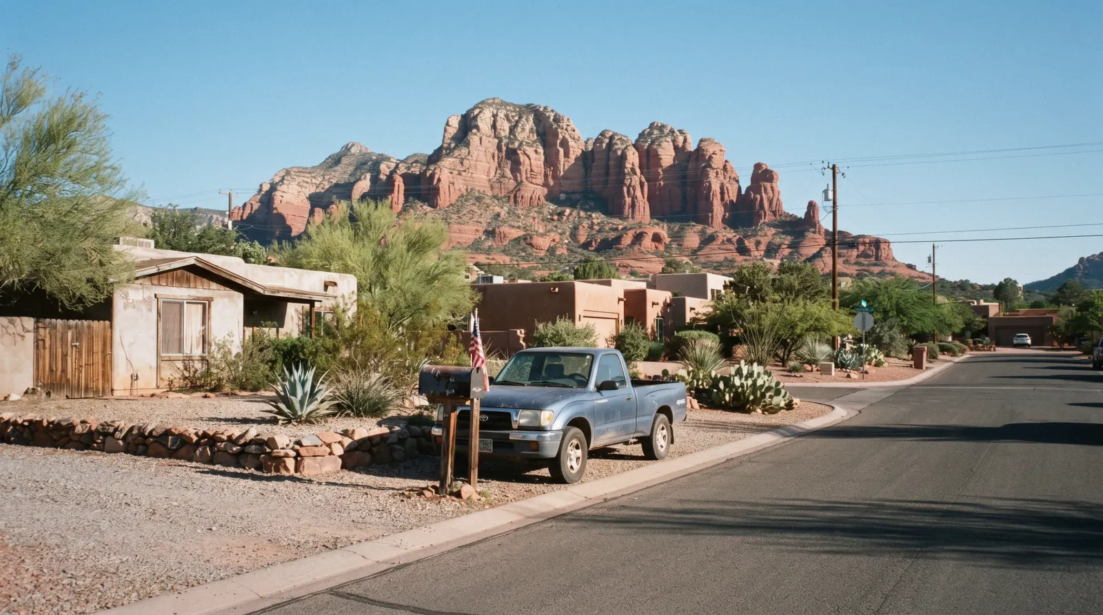
Sedona Neighborhoods
Sedona neighborhoods are less about culture or cuisine than about which highway you are on and which trailhead sits at the end of it. The town runs along two roads, SR-89A and SR-179, meeting at the junction everyone calls the Y, and the four areas below split out from there: Uptown at the Y itself, West Sedona along the highway to the west, the Village of Oak Creek south on SR-179, and Oak Creek Canyon climbing north toward Flagstaff. This page maps what each one is for, what sits within walking distance and what does not, and sends you to a full guide for the three that have one; it is one piece of the wider Sedona trip guide, which ties the areas to the trailheads, the passes and the season. Picking a place to sleep is a related but separate question, answered on where to stay in Sedona.
Quick answer Four areas, what each is for, and how they connect
Sedona splits into four areas around its two highways: Uptown at the SR-89A/SR-179 junction, with the shops, restaurants and Main Street evenings; West Sedona along SR-89A to the west, with groceries, mid-range hotels and the trailheads off Dry Creek Road; the Village of Oak Creek south on SR-179, near Bell Rock and Cathedral Rock; and Oak Creek Canyon, the forested stretch of SR-89A running north toward Flagstaff. There is no metro or walkable link between them; SR-89A and SR-179 are the only roads.
Key takeaways
- First stop for most visitors: Uptown Sedona, the SR-89A/SR-179 junction and Main Street on foot.
- Closest to the trails people actually come for: West Sedona for Devil's Bridge and Soldier Pass, Village of Oak Creek for Bell Rock and Cathedral Rock.
- The quiet, scenic drive north: Oak Creek Canyon, with Slide Rock and the West Fork Trail.
- Choosing where to sleep rather than where to spend an afternoon is a related, separate question: where to stay in Sedona.
Four areas compared: what they are for, what is walkable, where you park
What each area actually holds, what sits within walking distance of it, and the closest trailheads, read from Coconino National Forest trail pages and the site's own research as of in Q3 2026. No Sedona or Coconino National Forest page publishes formal neighbourhood boundaries, so the areas below follow the split competitor sites and the city's own map pages use.
| Area | What it is for | On foot | Parking | Closest trailheads |
|---|---|---|---|---|
| Uptown Sedona | Shops, restaurants, tour pickups, viewpoints | Main Street's full length, several overlooks | Paid and metered lots off Main Street; no Red Rock Pass needed here | Airport Mesa Loop, a short drive; most fee trailheads 10-15 minutes out |
| West Sedona | Groceries, local restaurants, mid-range lodging, the practical spine of town | A strip along SR-89A rather than a compact centre | Trailhead lots need a Red Rock Pass or the America the Beautiful pass | Soldier Pass, Doe Mountain, Fay Canyon, two of the three Devil's Bridge approaches |
| Village of Oak Creek | Golf, residential lodging, quiet evenings | A grocery store and a handful of restaurants; no walkable strip | Red Rock Pass required at the Bell Rock and Courthouse Butte lots | Bell Rock Pathway, Courthouse Butte Loop, Cathedral Rock via Back O'Beyond Road |
| Oak Creek Canyon | Scenic drive, forest and creek, a handful of lodges | Individual pullouts and short paths, not a town centre | Slide Rock charges its own state-park vehicle fee, not a Red Rock Pass; the Call of the Canyon lot for West Fork charges its own day-use fee | Slide Rock State Park and the West Fork Trail, both directly off SR-89A |
Cottonwood and Flagstaff also come up in searches for Sedona's areas; both sit outside town and are covered as lodging alternatives on where to stay in Sedona and as day-trip destinations on day trips from Sedona, not as neighbourhoods of Sedona itself.
The four areas on the map
Terracotta pins mark each area's centre; the green pin is the SR-89A/SR-179 junction, the Y, that every drive time on this page is measured from. Coordinates are area centres read from public map data, not surveyed boundaries, since none are published for Sedona.
Tours that cross more than one area
Two cards that move through several of the areas above in one trip, useful for getting oriented before you decide where to spend a full afternoon. Prices and ratings current as of in Q3 2026.
 from $126
Most-reviewed sightseeing tour on this page (212 reviews)
from $126
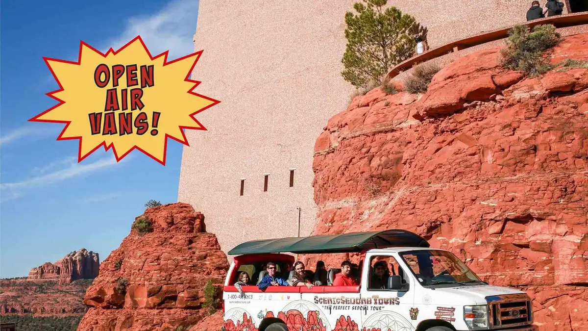
Most-reviewed sightseeing tour on this page (212 reviews) Sedona: Open-Air Van Tour with a Local Guide and 6 Stops
A longer open-air van circuit with six stops mixing sightseeing, shopping and food rather than a single scenic loop. Suits visitors who want to break up the drive with time on foot at each stop.
Check Availability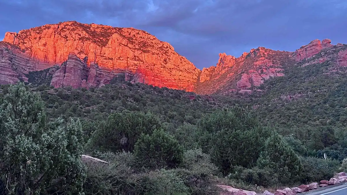 from $135
Sedona: E-Bike Sunset Tour Dry Creek area and Stupa
A paved e-bike route through the Dry Creek area to the Amitabha Stupa, combining a red rock ride with a stop most visitors otherwise drive to. Suits riders who want to see the Stupa as part of an active outing rather than a quick parking-lot visit.
Check AvailabilityPrices, ratings and details are the platform's own, checked in Q3 2026; dollar figures are the listed prices — the platform bills in your account's currency.
How Sedona is actually laid out
Two highways, one junction
Sedona has no downtown grid in the usual sense; it is built along SR-89A, which arrives from Flagstaff through Oak Creek Canyon and continues west toward Cottonwood, and SR-179, which runs south toward the Village of Oak Creek and on to I-17. The two meet at the junction everyone in town calls the Y, and that junction is the reference point for every other area: Uptown surrounds it directly, West Sedona is SR-89A heading west from it, the Village of Oak Creek is SR-179 heading south from it, and Oak Creek Canyon is SR-89A heading north from it.
Elevation drops as you go south
Sedona sits around 4,500 ft, per the city's own visitor bureau, and the terrain is not flat across it: Oak Creek Canyon climbs toward Flagstaff's 6,821 ft, while the Village of Oak Creek, further south along SR-179, sits at a somewhat lower elevation in the open red-rock basin. That gradient is part of why Oak Creek Canyon reads as a forest, not a desert, while the Village of Oak Creek reads as open red-rock country.
No shuttle or bus links all four
The free Sedona Shuttle is a trailhead service, not a town circulator: it connects a Park & Ride lot to five specific trailheads, Cathedral Rock, Little Horse, Soldier Pass, Dry Creek Vista and Mescal, Thursday to Sunday, 7:00 am to 5:30 pm. It does not run a fixed Uptown-to-West-Sedona-to-Village-of-Oak-Creek loop. The one scheduled bus that does connect Sedona to another town is the Verde Lynx, which links West Sedona and Uptown stops to Cottonwood, not to the Village of Oak Creek or Oak Creek Canyon.
Moving between the four areas on this page is, in practice, always a car.
Uptown: the walkable centre
Uptown is the small grid of streets right at the Y, anchored by Main Street's shops, galleries and restaurants, with several roadside viewpoints that need only a short walk. It is also where most jeep and van tours pick up, which makes it the default first stop for a lot of visitors regardless of where they sleep. The trade for that convenience is traffic: the Y itself is Sedona's busiest intersection, and Main Street carries foot and vehicle traffic well into the evening.
Two of the area's paid stops need no Red Rock Pass at all: the Sedona Heritage Museum, $10 adult and free under 13, open daily 11:00 am-3:00 pm; and Tlaquepaque Arts & Shopping Village, free to walk, open Monday-Thursday 10:00 am-5:00 pm and Friday-Sunday 10:00 am-6:00 pm. From Uptown, Airport Mesa's loop trail is a short drive, and most of the fee trailheads that need a Red Rock Pass sit ten to fifteen minutes out along SR-89A or the side roads off it. Both close on Thanksgiving and Christmas, and Tlaquepaque's parking is free in the lots that surround the property, with an extra lot across the street and a Sedona Shuttle stop nearby for anyone who would rather not drive in at all. Street-by-street detail, current shop hours and what a stay here actually costs are on the Uptown Sedona guide.
West Sedona: the practical spine
West Sedona runs along SR-89A west of the Y, and it is where residents and repeat visitors do the actual shopping: grocery stores, pharmacies, and a strip of local restaurants without Uptown's gallery-and-gift-shop density. It has none of Uptown's walkable centre, but it sits closest to the Dry Creek Road cluster of trailheads. Soldier Pass, toward the Uptown end of the area, is 4 miles round trip with 641 ft of elevation gain, rated Moderate; Doe Mountain climbs 0.7 miles to its mesa top (1.3 miles for the full rim loop), 542 ft of gain; Fay Canyon is the easy one at 2.1 miles round trip and 144 ft of gain. Devil's Bridge has three approaches reached from this side of town, each a different road rather than a different walk: the short 1.6-mile Dry Creek Road route needs high clearance, the Mescal trailhead route is 4.0 miles, and the Dry Creek Vista route via the Chuckwagon connector is 5.8 miles.
Every trailhead here still needs a car, and every fee trailhead needs a Red Rock Pass or an America the Beautiful pass at the lot. What differs from Uptown is the drive length, often five to ten minutes rather than fifteen. The area's full guide, with its own restaurants and what the streets look like after dark, is West Sedona.
Village of Oak Creek: golf, quiet, Bell Rock
South of Uptown on SR-179, the Village of Oak Creek, known locally as Big Park, grew up as a separate community around its golf courses and has since become part of the same visitor map as Sedona proper, without ever being annexed into the town's Uptown-centred layout. It has its own grocery store and a small run of restaurants, but nothing resembling a walkable strip, and no stop on the free Sedona Shuttle. The Chapel of the Holy Cross sits along the same SR-179 corridor, free and open 9:00 am-4:45 pm daily.
What makes the area worth knowing for trail access: Bell Rock Pathway runs 3.5 miles one way, rated Easy on a wide hard surface; the Courthouse Butte Loop, from either the Courthouse Vista or Bell Rock Vista trailhead, is 3.8 miles round trip, rated Moderate; and Cathedral Rock's own trail, via Back O'Beyond Road a short drive further, is the outlier at just 1.1 miles round trip but 669 ft of gain, rated Strenuous and closer to a rock scramble than a hike. Every one of those lots needs a Red Rock Pass. The area's own streets, its golf-resort lodging and its distance from Uptown's restaurants are on the Village of Oak Creek guide.
Oak Creek Canyon: the scenic drive north
North of Uptown, SR-89A climbs into Oak Creek Canyon on its way to Flagstaff, a twelve-mile stretch of forested walls that is itself one of the sights on most visitors' lists, not just a road to somewhere else. A handful of lodges, cabins and small restaurants sit along it, and two fee-charging sites anchor the drive. Slide Rock State Park charges a per-vehicle fee that changes by season rather than a Red Rock Pass, $30 for one to four adults from late May through August 21, 2026, dropping to $20 through April 2027. The Call of the Canyon day-use area for the West Fork Trail charges its own fee, $15 a day for up to five people; the maintained, easy first 3 miles of that trail is 2-3 hours round trip, with the full canyon route running to 14 miles for experienced hikers.
This is the quietest of the four areas and the least commercial; there is no strip to walk and few shops. Full hours, fees and what the trail actually involves are on the Oak Creek Canyon guide, which also covers the drive itself as a scenic route in its own right.
Which area fits which kind of trip
A short first visit built around the well-known viewpoints and an evening out usually does best in Uptown, where the walk from a restaurant back to a hotel room does not involve a car, and the tour pickups are on the doorstep. A trip built entirely around hiking, where the point of the day is the trail rather than the town, does better in West Sedona or the Village of Oak Creek, both of which shave real minutes off the drive to a trailhead compared with Uptown, at the cost of an evening spent driving somewhere to eat rather than walking there.
Families balancing kids' energy against heat tend to do well in the Village of Oak Creek, where Bell Rock Pathway's Easy rating and hard-packed surface suit younger legs better than Cathedral Rock's Strenuous scramble, with a grocery store close by rather than a drive into Uptown for supplies. Photographers chasing sunrise and sunset light without a long drive beforehand often choose Oak Creek Canyon or the Village of Oak Creek for the same reason stargazers do: less light and less traffic between the room and the shot. Anyone travelling on a tighter budget, or planning a Jerome or Verde Valley wine day anyway, is the one profile this page sends out of town entirely, to Cottonwood.
What is not a Sedona neighborhood, and comes up anyway
Three names show up in the same searches as Sedona's own areas and deserve a straight answer rather than a card of their own. Cottonwood is a separate Verde Valley town about half an hour southwest of Sedona by car, or a Verde Lynx bus ride away; it has no trailhead of its own inside Sedona's Coconino National Forest system and functions as a lower-cost lodging base, covered on where to stay and day trips. Flagstaff is a separate city entirely, at 6,821 ft against Sedona's roughly 4,500 ft, reached via SR-89A through Oak Creek Canyon; it is the sensible base for the Grand Canyon and the sights around it, not a part of Sedona, and it has its own guide on Flagstaff from Sedona. Jerome, the old copper-mining town perched over 5,000 ft in the Black Hills southwest of Sedona, is a day-trip destination with its own state historic park, not a Sedona base at all; it has its own guide on Jerome, Arizona.
Tlaquepaque and the Chapel area, named for Tlaquepaque Arts & Shopping Village and the Chapel of the Holy Cross, are landmarks rather than lodging districts: both sit inside or just south of Uptown along SR-179 and are visited as stops, not booked as a base.
Getting between the four areas, in practice
The free shuttle is a trailhead service, not an area-to-area bus
The Sedona Shuttle runs Thursday to Sunday, 7:00 am-5:30 pm, with 15-45 minutes between pickups depending on the route, and it connects Park & Ride lots to five specific trailheads: Cathedral Rock, Little Horse, Soldier Pass, Dry Creek Vista and Mescal. It is free, needs no reservation, and is wheelchair accessible with racks for up to three bikes. None of that reaches Oak Creek Canyon or the Village of Oak Creek's own centre; it solves the Red Rock Pass parking problem for a handful of West Sedona and Uptown-side trailheads, not the question of moving between the four areas themselves.
The Verde Lynx crosses one boundary, not four
The one scheduled local bus that does connect two of the destinations on this page's wider map is the Verde Lynx, jointly run by the cities of Cottonwood and Sedona with the Arizona Department of Transportation: ten stops inside Sedona (West Sedona, Uptown, Hillside, Poco Diablo) and two in Cottonwood, a reported $2 one-way fare or $40 for a 20-ride pass, multiple trips daily, about 30 minutes from the Cottonwood Library to Tlaquepaque. It does not reach the Village of Oak Creek or Oak Creek Canyon, which is one more reason those two areas are effectively car-only.
Roundabouts, not traffic lights, at the Y and along SR-179
The Arizona Department of Transportation rebuilt the SR-89A/SR-179 junction and several intersections along SR-179 toward the Village of Oak Creek, including Canyon Drive, Morgan Road and Chapel Road, with roundabouts rather than signals, confirmed by the City of Sedona's own news pages. Neither page states an exact total count of roundabouts on the network, so none is printed here; the practical point for anyone driving between areas is that the Y itself, Sedona's busiest junction, now runs as a roundabout rather than a light.
Why the elevation and the season matter to which area you pick
Sedona's elevation, roughly 4,500 ft per Visit Sedona, sits well below Flagstaff's 6,821 ft and above the open desert further south, and that gradient shows up area by area: Oak Creek Canyon, shaded and creek-fed, runs noticeably cooler than the open red-rock basin around the Village of Oak Creek. The National Weather Service recommends strenuous outdoor activity in the coolest part of the day, generally 4:00-7:00 am, and 1 to 2 litres of water an hour outdoors, regardless of which area a hike starts from.
The Arizona monsoon runs a fixed window, June 15 through September 30, busiest in August, and the National Weather Service's Flagstaff office issues flash-flood warnings specifically naming Oak Creek and Sycamore Canyons: normally dry washes and swimming holes can carry dangerous currents during a warning. That risk sits mostly with Oak Creek Canyon and any trail that crosses a wash, not with Uptown, West Sedona or the Village of Oak Creek equally, so checking the forecast before a canyon day matters more if that is where you are headed.
Dogs, drones and the dark sky: the small print that differs by area
Sedona was designated an International Dark Sky Community by DarkSky International in August 2014, the world's eighth, and the open sky over the Village of Oak Creek and the western stretch of West Sedona reads noticeably darker than the canyon, where the forest canopy in Oak Creek Canyon blocks as much sky as it protects. Anyone choosing an area partly for stargazing is choosing an open-sky area over a forested one, a separate consideration from the trailhead questions above.
Dogs are allowed on Coconino National Forest trails leashed and cleaned up after, which covers the trailheads around West Sedona and the Village of Oak Creek, but pets are not allowed on the grounds of the Red Rock Ranger District's heritage sites, and Arizona State Parks bars pets entirely at Red Rock State Park. Drones cannot launch, land or operate from within a designated wilderness area, which includes the Red Rock-Secret Mountain Wilderness that several West Sedona and Village of Oak Creek trails run through, and general Forest Service airspace rules require staying below 400 ft, in line of sight, and five miles clear of towered airports absent authorisation.
Turn the map into a plan
Pick where to sleep
The same four areas, plus Cottonwood and Flagstaff, compared for lodging specifically: where to stay in Sedona.
No official rate index publishedGetting between the areas
The free shuttle's routes, the Verde Lynx bus and what a rental car adds: getting around Sedona.
Shuttle runs Thursday-SundayWhich trailheads need a pass
The full list of fee sites by area, and which five sites the free shuttle actually reaches: the Red Rock Pass.
From $5 a daySedona neighborhoods: questions
How many neighborhoods does Sedona have?
This site maps four, split by the two highways that structure the town: Uptown at the SR-89A/SR-179 junction, West Sedona along SR-89A to the west, the Village of Oak Creek south on SR-179, and Oak Creek Canyon north on SR-89A. See the comparison table.
Can I walk between Uptown and West Sedona?
Not practically. SR-89A runs between them without a continuous pedestrian route built for the distance, and there is no bus that circulates between all four areas; every crossing is by car. See how Sedona is laid out.
Which Sedona area is closest to the trailheads?
It depends which trail: West Sedona for Devil's Bridge and Soldier Pass, the Village of Oak Creek for Bell Rock and Cathedral Rock, Oak Creek Canyon for Slide Rock and the West Fork Trail. See the comparison table.
Are Cottonwood and Flagstaff part of Sedona?
No. Both are separate towns that come up in the same searches: Cottonwood is a Verde Valley base reached by car or the Verde Lynx bus, and Flagstaff is a mountain city reached by car through Oak Creek Canyon. Neither has a Sedona trailhead of its own. See what is not a Sedona neighborhood.
Do these areas charge for parking just to visit them?
No, not to be in the area itself. A parking permit is required at most Forest Service trailhead lots inside West Sedona and the Village of Oak Creek, not to park on the street or at a restaurant; the full rules are on the parking-pass page.
What is the Village of Oak Creek called locally?
Big Park, a name that predates its absorption into Sedona's tourist map. See the Village of Oak Creek section.
Is there public transport between the Sedona areas?
Only partially. The free Sedona Shuttle runs Thursday-Sunday and connects Park & Ride lots to five trailheads, and the Verde Lynx bus links West Sedona and Uptown stops to Cottonwood; neither is a circulator between all four areas, and the Village of Oak Creek and Oak Creek Canyon have no scheduled bus service of their own. See getting between the four areas.
Sedona Neighborhoods: On Video
Three walkthroughs of the areas above, filmed street by street rather than described from a map.
Your Guide to Sedona Living: Exploring the Best Neighborhoods
A general tour of the areas that make up greater Sedona, filmed on the ground.
Video: Living in Northern ArizonaTop Five Sedona Neighborhoods
A rundown of five Sedona-area districts, including several covered on this page.
Video: Living in Northern ArizonaVillage of Oak Creek Sedona Driving Tour: Homes, Hiking, and Local Life
A driving tour through the Village of Oak Creek specifically, showing its golf-course layout and trail access.
Video: Sedona Luxury HomesVideos load from YouTube only when you press play.
Reviewed Q3 2026 (July–September 2026); next review Q4 2026. Prices, hours and terms are set by the venue or operator and confirmed at checkout.
We may earn a commission if you book through one of our links, at no extra cost to you. Full affiliate disclosure