 Sedona City Guide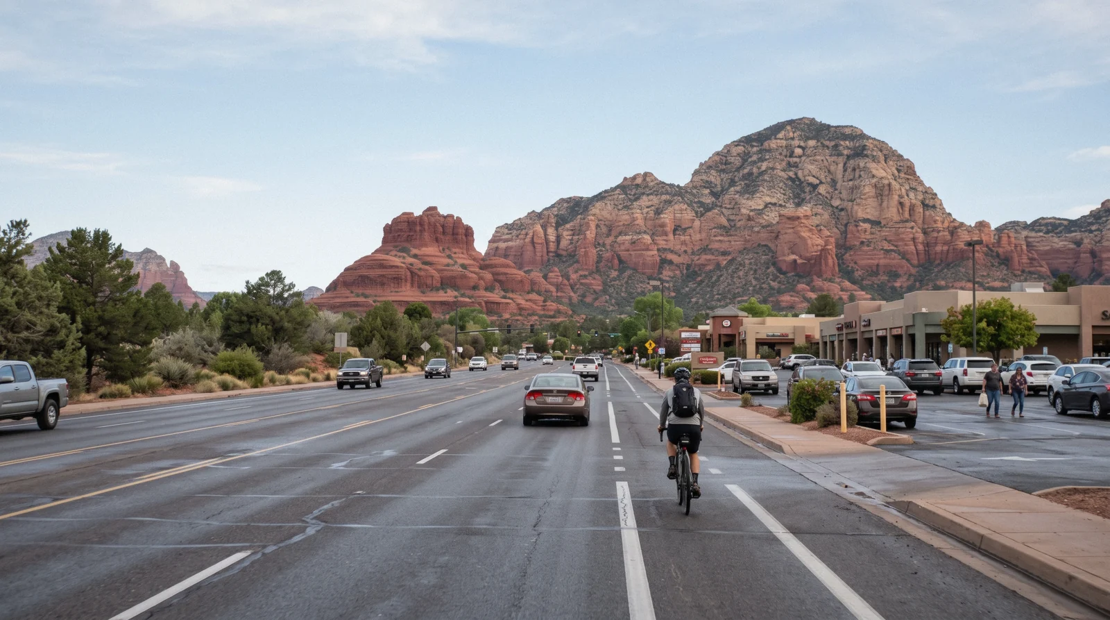
West Sedona
West Sedona is the long stretch of State Route 89A running west from the Y junction toward the Dry Creek Road turnoff: several miles of strip malls, grocery stores, chain restaurants and residential streets, where Sedona's own residents actually shop. It has none of Uptown's gallery density and none of the Village of Oak Creek's distance from town, and it sits closest to the largest cluster of named trailheads in the area. This page is one piece of the wider Sedona guide, covering the strip itself, the Amitabha Stupa, which trailhead is closest from which part of it, parking, and what a room costs here against the other two districts.
Quick answer The resident strip, the trailheads, what's free
West Sedona is the several-mile stretch of SR-89A west of the Y junction where the town's grocery stores, gas stations and everyday restaurants sit, and it is the closest district to most of Sedona's named trailheads. Parking is free throughout, unlike Uptown.
Key takeaways
- West Sedona is the shortest drive to Devil's Bridge, Soldier Pass, Boynton Canyon and Doe Mountain, all reached off Dry Creek Road within about ten minutes of the strip.
- The free Amitabha Stupa and Peace Park sits on Pueblo Drive off the strip and is open dawn to dusk.
- Parking here is free surface lots throughout, unlike Uptown, which meters; see how the two compare.
- A room here typically costs less than Uptown for a shorter drive to the trailheads; what that costs is below.
West Sedona against Sedona's other two districts
A side-by-side of the three areas covered on this site, read in Q3 2026 against parking rules published by the City of Sedona and Coconino National Forest and against nightly-rate bands checked the same day.
| Area | Parking | On foot from a hotel | Closest trailheads | After 8pm |
|---|---|---|---|---|
| West Sedona | Free surface lots | Groceries and a handful of restaurants along SR-89A | Closest to Devil's Bridge, Soldier Pass, Boynton Canyon, Doe Mountain | Residential; most restaurants close by 21:00 |
| Uptown Sedona | Paid: meters and a public garage | The shopping strip and Midgley Bridge | 20+ minutes' drive to most Dry Creek and Bell Rock trailheads | Quiet; shops close, restaurants keep going a little later |
| Village of Oak Creek | Free surface lots | Little beyond the shopping center it sits in | Under Bell Rock and Courthouse Butte | Quietest of the three; a drive back up for anything in town |
Parking status is confirmed for Uptown's meters and garage and for the free Forest Service trailhead lots; the free-parking claim for ordinary streets in West Sedona reflects the absence of any published metering there, not a specific city ordinance we could cite.
Tours that start from this side of town
The e-bike, hiking and canyon tours that run from the Dry Creek and West Sedona trailheads themselves; prices and ratings as listed in Q3 2026.
 from $135
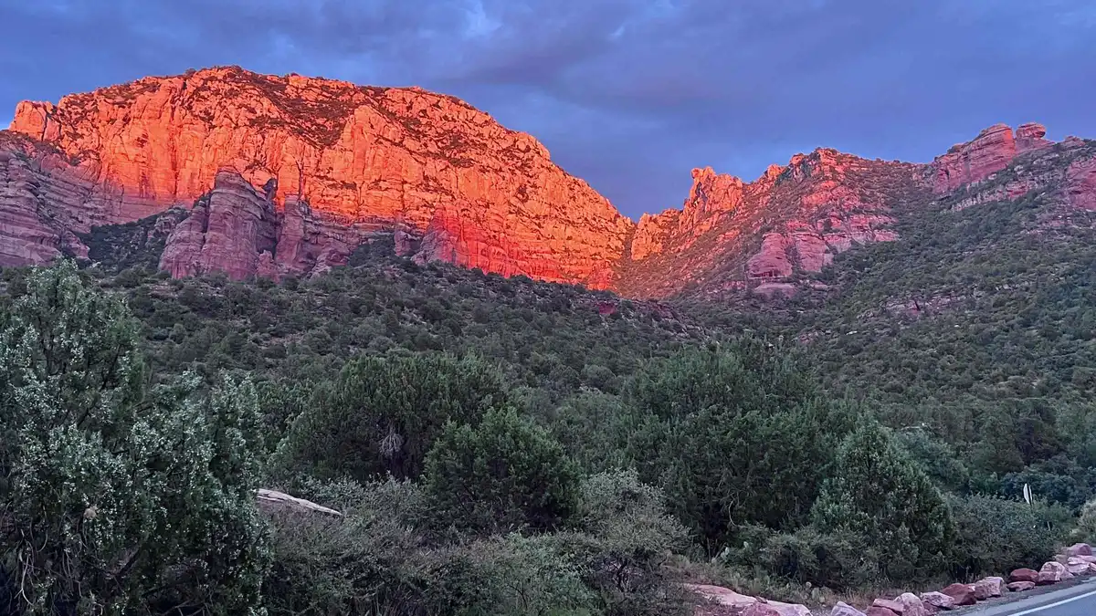
Sedona: E-Bike Sunset Tour Dry Creek area and Stupa
A paved e-bike route through the Dry Creek area to the Amitabha Stupa, combining a red rock ride with a stop most visitors otherwise drive to. Suits riders who want to see the Stupa as part of an active outing rather than a quick parking-lot visit.
Check Availability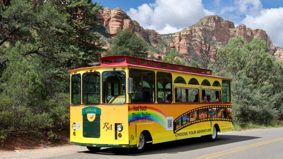 from $27.60
From Sedona: Boynton Canyon Trolley Tour
A 50-minute trolley ride toward Boynton Canyon covering Sedona's western movie history and Native American heritage with photo stops. Suits visitors who want a short, low-effort ride rather than a hike into the canyon itself.
Check Availability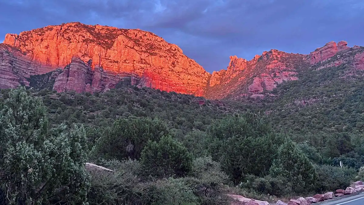 from $121.50
Sedona: E-Bike Sunset Tour to Red Rock Vistas
A paved e-bike loop past several trailheads to red rock viewpoints timed for sunset, staying on roads rather than singletrack. Suits riders who want scenery without off-road handling. A new listing on GetYourGuide with no reviews yet.
Check Availability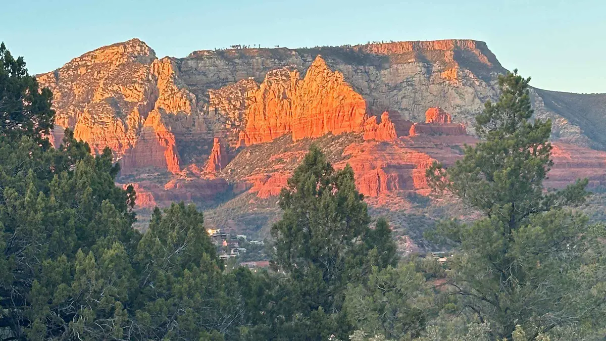 from $275
Sedona: Guided Wilderness Hiking Tour
A guided hike on off-the-beaten-path backcountry trails away from the busier named trailheads, aimed at travelers who have already done Cathedral Rock or Devil's Bridge. Suits repeat visitors who want less foot traffic over a bucket-list summit.
Check Availability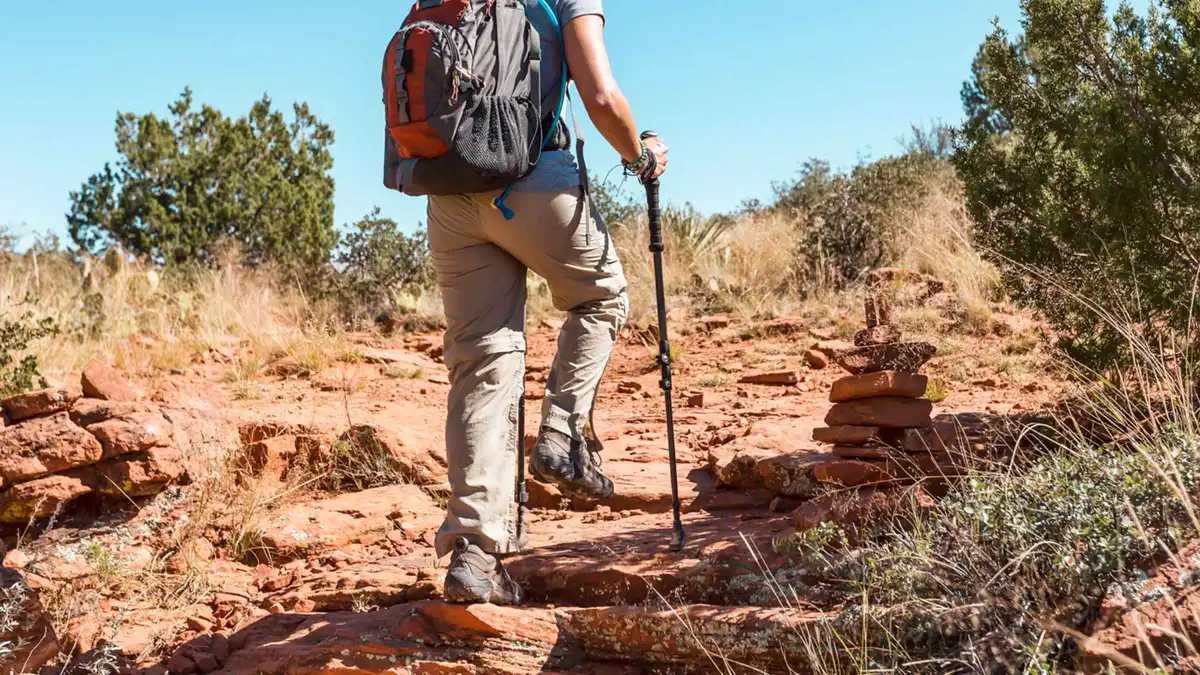 from $123.86
From Sedona: Archeology and Nature Hike
A Jeep ride to a private access point followed by a short, flat 2-mile hike to Native American ruins, positioned as an easier alternative to Palatki or Honanki. The same Sinagua-era dwelling style can be seen without a guide at Palatki Heritage Site, which requires a Red Rock Pass plus a free Recreation.gov reservation.
Check AvailabilityPrices, ratings and details are the platform's own, checked in Q3 2026; dollar figures are the listed prices — the platform bills in your account's currency.
What West Sedona actually is
A resident strip, not a tourist strip
West Sedona runs along SR-89A from roughly the Y junction west to the Dry Creek Road intersection and beyond, several miles of strip development that grew up because this was flat, buildable land compared to the terrain closer to Uptown. It is where the supermarkets are (Safeway and Bashas both sit on this stretch), the gas stations, the hardware store, banks, and most of the chain and mid-range restaurants that residents actually use day to day.
Unlike Uptown, it was never built primarily for visitors, so it reads as ordinary strip-mall Arizona rather than a Sedona postcard. That is also its advantage: this is where you go to buy groceries for a self-catered stay, fill a gas tank before a day trip, or eat somewhere that is not priced for a captive tourist crowd.
Where the Dry Creek Road trailheads begin
Dry Creek Road turns north off SR-89A partway along the West Sedona strip and climbs toward the cluster of trailheads that includes Devil's Bridge's own high-clearance access road, the Mescal trailhead, Dry Creek Vista, Boynton Canyon and Doe Mountain. This is the single biggest reason to base in West Sedona over the other two districts: no other part of Sedona sits this close to this many named trails.
Which trailhead is closest, and the 7:00 am versus 10:00 am lot
The Dry Creek cluster
From the West Sedona strip, Dry Creek Road is a straight run of a few minutes to the turnoff, then a further stretch of unpaved, high-clearance road to reach Devil's Bridge's closest trailhead directly, which the Forest Service rates at 1.6 miles roundtrip and 371 feet of gain from that point. Drivers without a high-clearance vehicle use the Mescal trailhead instead, a 4.0-mile roundtrip, or the Dry Creek Vista trailhead via the Chuckwagon connector, a 5.8-mile roundtrip; the Forest Service does not publish a separate elevation-gain figure for either of the longer approaches. Boynton Canyon, a 6-mile out-and-back rated moderately challenging, and Doe Mountain, a short but steep 1.3-mile rim loop, sit a few minutes further up the same road system.
Soldier Pass Trail, 4 miles roundtrip with 641 feet of gain, is reached from a different trailhead closer to the strip itself, off Soldier Pass Road, and it is also one of the trailheads served by the free Sedona Shuttle on its published Thursday to Sunday schedule.
7:00 am against 10:00 am
No Forest Service page publishes a lot-capacity figure for any of these trailheads, so this page states what is observable rather than a number: arriving at Dry Creek Road's trailheads by 7:00 am on a weekend in spring or fall means a real chance of a space in the small unpaved lots; arriving at 10:00 am on the same day means the lots are very likely full and the shoulder of the road becomes overflow parking, which is both illegal where posted and a longer walk in. The gap between those two arrival times is the single most useful piece of trip-planning information for anyone based in West Sedona, and it is not published anywhere official; it is a pattern reported consistently by hikers and confirmed by how small the paved capacity actually is at each of these sites.
Amitabha Stupa and Peace Park
The Amitabha Stupa and Peace Park sits at 2650 Pueblo Drive, a short residential street off the West Sedona strip, and it is free to visit, supported entirely by donations. The grounds are open dawn to dusk daily; the parking lot itself keeps posted hours, 8:30 am to 6:00 pm in summer and 8:30 am to 5:00 pm in winter, seven days a week, though the site's own page does not state the exact date the hours switch between seasons.
It is a working Tibetan Buddhist monument, not a museum exhibit, and the etiquette that applies at any such site applies here: quiet voices, no climbing on the stupa itself, and circumambulation is traditionally done clockwise. It pairs naturally with a stop at one of the nearby Dry Creek trailheads on the same short drive from the strip, and an e-bike tour that routes past the Stupa and the Dry Creek trailheads is one way to see several of these in a single afternoon without moving a car between stops.
Groceries and the cheapest breakfast in town
Both of Sedona's full supermarkets sit on this stretch of SR-89A, along with the gas stations and the pharmacy most visitors end up needing at some point in a week-long stay. For a self-catered trip, or simply to avoid paying resort prices for a sandwich, West Sedona is the base that makes that possible.
The restaurants along the strip skew toward diners, casual Mexican and family-style breakfast spots rather than the view-driven fine dining that clusters closer to Uptown and along SR-179, and that is reflected in price: a breakfast plate here runs consistently below what the same meal costs at a restaurant marketed on its red-rock view. No official price register exists for Sedona restaurants, so this is a pattern rather than a figure, but it is the pattern residents themselves rely on.
Parking: free lots, but check the trailhead pass
Ordinary parking along the West Sedona strip, at the supermarkets, restaurants and shopping centers, is free, unlike Uptown's metered spaces and garage. That is the easy part. The trailheads reached from this district are a separate system entirely: a Red Rock Pass, or the America the Beautiful/Interagency pass as a substitute, is required to park at most Coconino National Forest fee sites, including Boynton Canyon, Dry Creek and the Cathedral Rock, Bell and Courthouse Vista lots elsewhere in town.
Devil's Bridge's own trailheads are on this list. The pass costs $5 for a day, $15 for a week or $20 for a year, sold through Recreation.gov, at fee-machine kiosks at the sites themselves, and at the Red Rock Ranger Visitor Center on SR-179. It does not cover the five concessionaire-managed sites, among them the West Fork/Call of the Canyon picnic area, which need a separate Coconino Hospitality Annual Pass instead.
Full detail on the Red Rock Pass page.
West Sedona at 8:00 pm
This is a residential and commercial strip rather than a destination in itself, so evenings here are quiet by design: most restaurants close by around 21:00, and there is no gallery-and-shop scene to walk after dinner the way there partly is in Uptown. What it does offer is convenience, since the restaurant choice along the strip is broader and generally cheaper than Uptown's, so staying here removes the question of whether to drive back into town for dinner that a stay in the Village of Oak Creek raises every evening.
What you actually pay: the county line runs through Sedona
Sedona sits across the Yavapai-Coconino county line, and the combined state, county and city sales tax differs depending on which side of it a purchase happens: 9.85% in the Yavapai County portion, 10.40% in the Coconino County portion, both including the state's flat rate and the city's own 3.5% retail tax in place since March 2018. Most of West Sedona's commercial strip sits in the Yavapai portion, so 9.85% is the working figure for a grocery run or a restaurant check along SR-89A here; we could not confirm the exact county line as it crosses every West Sedona parcel, so treat 9.85% as the figure that applies to the bulk of the strip and 10.40% as the rate on the Coconino side of town.
Hotel bills add a separate 3.5% lodging tax, bringing a room folio to roughly 13.35% to 13.9% combined depending on the county portion. That addition does not show up in the nightly rate quoted when you book.
Sleeping in West Sedona, and what that buys
The trade you are making
A room in West Sedona puts you closer to the trailheads than anywhere else in Sedona, closer to groceries and cheap food than either other district, and at a lower price than a comparable room in Uptown. It costs you the postcard view: this is strip-mall Arizona rather than red-rock backdrop from your window, and the evening is quiet by necessity rather than choice, since there is little to walk to after dinner.
For anyone whose trip is built around the trails, this is the base that removes the most drive time from every single day. What a night here actually costs is below, against the same date and method used for Uptown and the Village of Oak Creek.
West Sedona and its trailheads on the map
Terracotta pins mark the SR-89A strip itself. Green pins mark the Dry Creek Road trailhead cluster, reached in a few minutes from the strip.
From West Sedona, next
The closest big out-and-back
The trailhead and the three approaches compared: Devil's Bridge.
About 10 minutes by carThe busier, paid-parking district
Shops, galleries and jeep-tour desks on the strip at the Y: Uptown Sedona.
10-15 minutes by carHow Sedona's three areas compare
Parking, price and distance to the trails, side by side: Sedona neighbourhoods.
N/AWhat a room in West Sedona costs
The band is a reading of West Sedona-area listings checked in Q3 2026 for a midweek night, two adults, room only. It is one date, not a fixed price: rates run higher in spring and fall and lower in the height of summer, and any weekend prices above this band.
West Sedona
- Walk to the trailheads
- Not walkable to the trailheads; a short drive to all of them
- Typical double
- $150-$320 (no official rate schedule; a checked-date band, not a published price)
- Suits
- A trip built around hiking, with groceries and cheap food a few minutes away and no meter to feed
This is generally Sedona's lower-priced district for a comparable room, but you give up the walkable strip and the red-rock-backdrop views some properties elsewhere sell.
See stays in West SedonaRates read in Q3 2026 and quoted as a band, not a price; no single official source publishes West Sedona hotel rates. A 3.5% city lodging tax applies on top of the sales tax shown above. The other two districts, with the same method and date, are on where to stay in Sedona. We take a commission if you book through this link, at no extra cost to you.
West Sedona: questions
What is the difference between Sedona and West Sedona?
"Sedona" covers the whole town; West Sedona is one district within it, the several-mile stretch of SR-89A west of the Y junction where the supermarkets, gas stations and most everyday restaurants sit. It has none of Uptown's gallery density but sits closest to the largest cluster of named trailheads.
What is there to do in West Sedona?
Reach Devil's Bridge, Soldier Pass, Boynton Canyon and Doe Mountain trailheads in a few minutes' drive, visit the free Amitabha Stupa, stock up at either supermarket, or take an e-bike tour past the Dry Creek trailheads.
Is West Sedona a good place to stay?
For a hiking-focused trip, yes: it is closer to more trailheads than either other district and generally costs less per night than Uptown. For a stay built around walking to shops and restaurants in the evening, Uptown suits that better.
Do I need a Red Rock Pass to park in West Sedona?
Not for ordinary parking along the strip, which is free. You do need a Red Rock Pass, or the America the Beautiful pass as a substitute, at the Forest Service trailhead lots this district is close to, including Boynton Canyon and the Dry Creek Road sites; the pass is $5 a day, $15 a week or $20 a year. Full detail on the Red Rock Pass page.
What is the closest trailhead to West Sedona?
Soldier Pass Trail's own trailhead is the closest to the strip itself, a few minutes off SR-89A. The Dry Creek Road cluster, Devil's Bridge, Boynton Canyon and Doe Mountain, is a similarly short drive further along the same road.
How early should I arrive to get a parking spot at a West Sedona trailhead?
By around 7:00 am on a weekend in spring or fall for the small unpaved Dry Creek Road lots. No Forest Service page publishes a capacity figure, but by 10:00 am on the same day the lots are very likely full and overflow onto the road shoulder, which is illegal where posted.
West Sedona on video
Three drives and walkthroughs of the strip and the residential streets behind it.
Discover the Magic of West Sedona: Scenic Driving Tour through Western Hills and Eagle Rock
A driving tour through West Sedona's residential streets and the hills above the strip.
Video: LIVING IN SEDONA AZWest Sedona Neighborhood Tour | Real Estate, Trails & Views
A tour covering the trails reachable from this side of town alongside the neighborhood itself.
Video: Sedona Luxury HomesWest Sedona, Arizona - Vlog Tour
A ground-level walk and drive through the SR-89A strip.
Video: Living in Northern ArizonaVideos load from YouTube only when you press play.
Reviewed Q3 2026 (July–September 2026); next review Q4 2026. Prices, hours and terms are set by the venue or operator and confirmed at checkout.
We may earn a commission if you book through one of our links, at no extra cost to you. Full affiliate disclosure